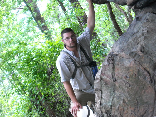
This access parking lot, located off Pinnacle Hotel Road, was well graveled with nice maps. One covered the 6mi Corridor Trail and the other was a layout of the equestrian section of the mountain. The mixed use bridle/hiking path runs 6.6mi up the corridor trail to where we were and then 1.7mi northeast along the Grassy Ridge Trail. Being only 2 legged packmules, Bullfrog and I decided to take the longer and less traveled path. A roundtrip along the 2.5mi (Strenuous) Mountain Trail, then another 1.0mi (Strenuous) Ledge Spring Trail loop, lunch at the Little Pinnacle Overlook, then back another 3.5mi to our Jeep.
http://www.ncparks.gov/Visit/parks/pimo/main.php
The Mountain Trail:
(Red Circle blazed) Starts on the other side of Pinnacle Hotel Road and parallels the road for almost 1/4mi with slight undulation and minor switching before making the turn NW and carving up and across the skirt of the mountain. The first quarter or less of the trail is well canopied with a sparse, leaf littered and rocky ground plane. The views across the forest floor seem to stretch for miles up and downslope with blaze being visible 3-5 minutes ahead at times. A few downed trees along the trail leave gaps in the blazing but the path is well cut in most places and the few turns tend to be gradual. There are some old logging trails that cut across, merge, and separate occasionally, but if you come to a junction with missing blaze, the one with no blowdowns is yours!
The next half of the trail angles around the shoulder of the mountain, SW, W, NW again as it rises and falls across the various draws and ridges cut into the base. I only counted a few weak springs along this area and most crick (too small to be fullblown creeks) crossings actually ran across the surface of the trail in easy to navigate segments. Bullfrog actually managed all of them with dry shoes and that's no mean feat! The azalea and rhododendron become bigger and more common, and the rock outcrops become less of a presence for a while as you are skirting fill that has loosened and slid down the mountain eons ago. Trees are still as big but undergrowth becomes thicker in places, thinner in others, misleading you into overestimating your elevation. This segment has some pretty good ups and downs so Bullfrog grabbed a branch off a fallen tree to help him keep some traction on the downhill parts, especially the rocky ones.
The last quarter of the Mountain trail gets pretty steep in places, with large (40ftx40ft and bigger) rock shelves on the uphill side of the trail making for good progress indicators. Trail is in pretty navigable condition but some of the clearings have let the azaleas become oppressive. Sometimes it felt like we were bushwhacking if not for the blaze 30 feet ahead. Mostly dry trail had excellent traction with all slopes easily climbable with nothing more than a pole or staff. A few turns can be confusing at times as by this time, you're expecting to come across the Ledge Spring Trail at any time. Just remember, if you come to a questionable intersection, stay on Red and look uphill. The trail turns right (Northeast) right before Ledge Spring and begins the only truly "strenuous" part of the hike. Steep and twisty rock and dirt ledges climb and switch back and forth until the trail ends at the painfully obvious and well marked Ledge Spring intersection. You WILL wonder how you ever thought you could miss it.
Ledge Spring Loop:
(Yellow Blaze until Grindstone intersection, then Yellow and Blue) We turned left at the intersection and followed Ledge around the topside of the bluffs. This is a very well groomed trail, more reminiscent of city hiking than mountain hiking. Very level, seems to be packed crush and run or gravel. Other than a few certain parts and water barriers, almost seems wheelchair accessible at this point (but is NOT). The trail heads West again before turning north then northeast in a very gradual switchback and intersecting with the Grindstone trail. Stay pointing NE and prepare to get your stairstepper on. We had been on our yellow blaze for 20 mins or so and left our walking sticks on the side of the trail as markers for the return trip. 2 minutes after that, we wished we had them again! This is where the Ledge Spring gets it's "Strenuous" descriptor. Hundreds of landscape timber and earth stair treads climb up the backside of the bluffs, not too bad for adult legs, but brutal for a child. Bullfrog ended up walking along the very edge where the fill was only 2-4 inches per step and was still working harder than he had all day. This was the ONLY time he stopped talking!
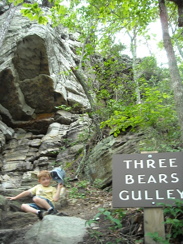
The steps ended and the gradual slope began again, running alongside a split rail fence that guards the climbing face of the bluffs from casual hikers. We passed 3 Bears gulley and topped Little Pinnacle about 4 hours after we started, just in time for a late lunch. Bad for us was the work crew at the Rest Area on the peak, they had the bathrooms and water fountains closed off for renovations, but we had enough in reserve to have lunch and safely back down.


Got some nice pictures and a break, then headed back downhill, shortcutting through the fairly steep, rocky 3Bears Gulley and along the bottom of the climbing faces (Southern side of Ledge Spring Trail) and were treated to some beautiful views from the bottom. Steep overhangs and lips made me nervous but Bullfrog really enjoyed the (necessarily brief) lecture on sedimentary rocks and why there are layers. Made it down without incident and a few more pictures just before the thunderheads hit the side of the mountain.
Total Hike Distance: 8mi
Total Elevation Change: 1400ft up, once I get a GPS we'll start posting trail profiles
Total Time: 6hours
Summary: A fun midlength day hike, dry feet, and the view is alot prettier if you hike rather than drive. Trail is very navigable, only a few trouble spots listed above.
I give it a B+.
Bullfrog gives it two very tired and dirty thumbs up.
If my 5 year old can do this....anyone can!
ReplyDelete